The New IRIS EMC 3D Visualizer
Since November 2011 IRIS Data Management Center (DMC) Earth Model Collaboration (EMC) data product has served as a community-supported repository of Earth models aimed at providing access to various Earth models under a uniform format (netCDF) and providing 2D visualization tools for model preview. The EMC repository currently holds:
- 26 seismic velocity models (3D)
- 7 reference Earth models (1D)
- 1 seismic attenuation (Q) model (3D)
- 1 electrical conductivity model (3D)
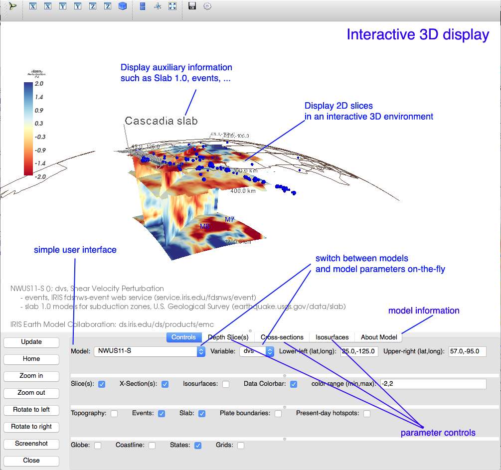
The new IRIS EMC 3D Visualizer, with its simple interactive 3D visualization capabilities, compliments EMC’s existing 2D visualization tools in a framework of open source Python desktop application and is based on MayaVi Data Visualizer 3D application. The 3D Visualizer’s simple user interface (UI), minimum reliance on external packages and ability to work directly with the Earth models in netCDF format makes this viewer an effective 3D tool to bridge the gap between the existing EMC’s web-based 2D visualization tools and the very complex viewers such as UNAVCO IDV (Integrated Data Viewer) and ParaView (Parallel Visualization Application).

The EMC 3D Visualizer’s flexible configuration parameters allow users to create region-specific parameter files that can be used to create customized view of the models. In addition, UI’s ability to change model/parameters in the same scene allows visual model comparison. The visualizer bundle contains the following 4 customized parameter files that cover all the existing EMC 3D Earth models:
- USA_W.py — parameters for western United States. Includes all models with coverage limited to western US.
- NorthAmerica.py — parameters for models covering United States and North America
- World.py — parameters for global models
- Taiwan.py — parameters for the Taiwan model
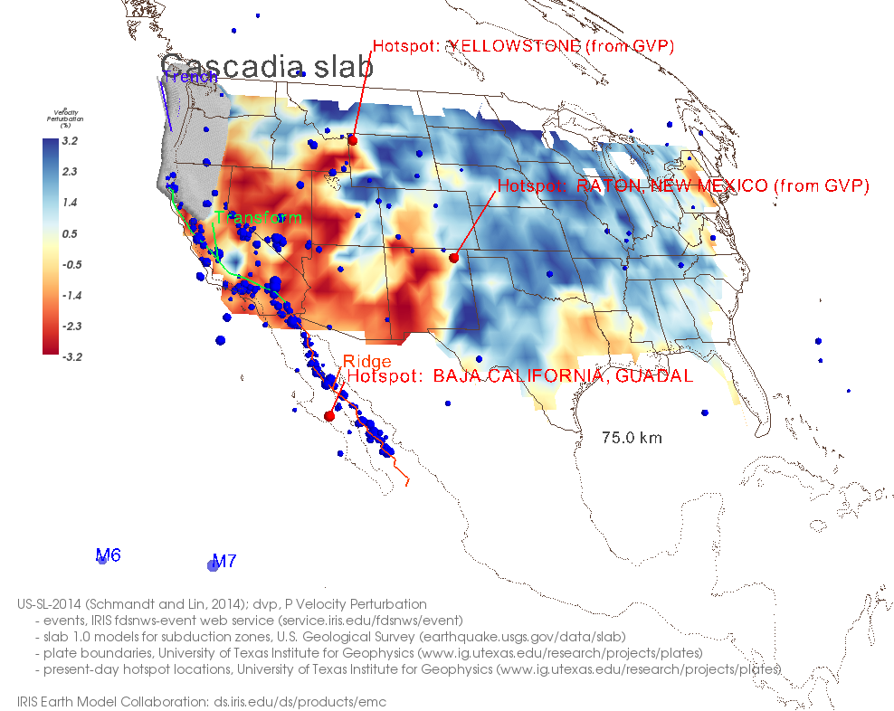
In addition to displaying horizontal and vertical slices and isosurfaces from the loaded model, the script is configured to plot events from the IRIS Event Web Service, ETOPO5 topography, slab models for subduction zones and plate boundaries and the present-day hot spots. Changing the source of the auxiliary data or adding customized auxiliary data in many cases is simple and requires minimum coding and modification.
We welcome patches and enhancements to this software. When developing patches, please pay particular attention to ease of use and maintenance and also keep dependencies to a minimum.

by Manoch Bahavar (IRIS Data Management Center) and Chad Trabant (IRIS DMC)


