Summary
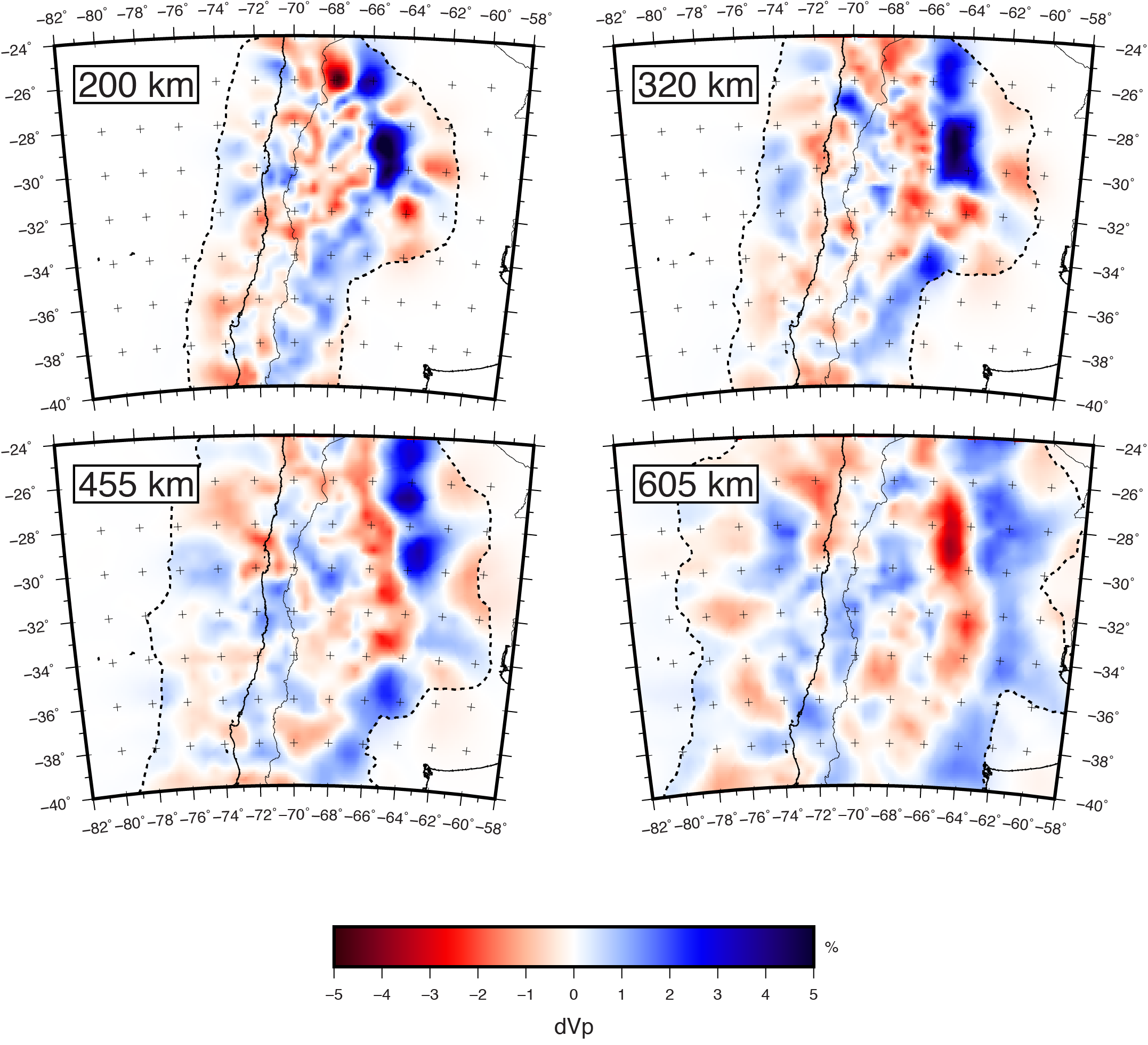
SAM4_P_2017 is a regional finite-frequency teleseismic P-wave tomography model for central Chile and Argentina. It uses relative arrival time residuals from 678 earthquakes recorded at 394 stations of a variety of temporary and permanent seismic deployments in Chile and Argentina.
Quicklinks
Description
| Name | SAM4_P_2017 |
| Title | Regional finite-frequency teleseismic P-wave tomography model for central Chile and Argentina |
| Type | 3-D Tomography Earth Model |
| Sub Type | Relative P-wave velocity (%dVP) |
| Year | 2017 |
| Short Description | This model uses relative arrival time residuals from 678 earthquakes recorded at 394 stations of a variety of temporary and permanent seismic deployments in Chile and Argentina. Residuals are measured in four frequency bands and inverted in a finite-frequency tomographic inversion. |
| Authors: | |
| Daniel Evan Portner | |
| Department of Geosciences | |
| University of Arizona | |
| Tucson, AZ USA | |
| Susan Beck | |
| Department of Geosciences | |
| University of Arizona | |
| Tucson, AZ USA | |
| George Zandt | |
| Department of Geosciences | |
| University of Arizona | |
| Tucson, AZ USA | |
| Alissa Scire | |
| IRIS PASSCAL Instrument Center | |
| New Mexico Institute of Mining and Technology | |
| Socorro, NM USA | |
| Previous Model | None |
| Reference Model | IASP91 |
| Model Download | |
| The above model expressed as P velocity in percentage with respect to the reference iasp91: SAM4-P-2017_percent.nc (see metadata ), is the netCDF file for the model |
|
| Depth Coverage | From 60 km to 1010 km (best resolution 200-900 km). |
| Area | Central Chile and Argentina (latitude: -48° to -17°; longitude: -85° to -53°) |
| Data Set Description | This model uses relative arrival time residuals from 678 earthquakes recorded at 394 stations of a variety of temporary and permanent seismic deployments in Chile and Argentina. |
| Supplemental Information | Please see the supplemental material that comes with the reference. |

Citations and DOIs
To cite the original work behind this Earth model:
- Portner, D.E., Beck, S., Zandt, G., & Scire, A. (2017) The nature of subslab slow velocity anomalies beneath South America, Geophysical Research Letters, 44, https://doi.org/10.1002/2017GL073106.
To cite IRIS DMC Data Products effort:
- Trabant, C., A. R. Hutko, M. Bahavar, R. Karstens, T. Ahern, and R. Aster (2012), Data Products at the IRIS DMC: Stepping Stones for Research and Other Applications, Seismological Research Letters, 83(5), 846–854, https://doi.org/10.1785/0220120032.
DOI for this EMC webpage:
Credits
Model provided by Daniel Evan Portner
Timeline
- 2017-07-11
- online


